
The Ministry of Forests Wildfire Branch issued an update on Tuesday, July 14, 2015, on the northeast fires.
Update of fire situation: 116,27l0 hectares burning in northeast BC
The Ministry of Forests Wildfire Branch issued an update on Tuesday, July 14, 2015, on the northeast fires.
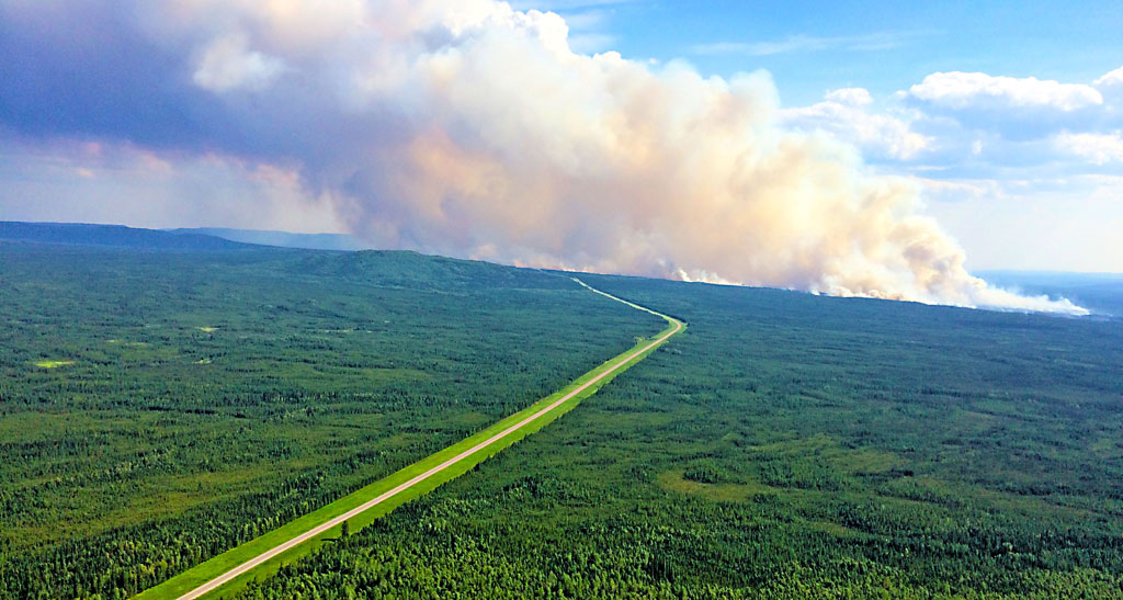
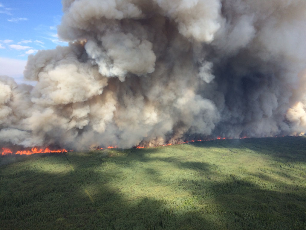
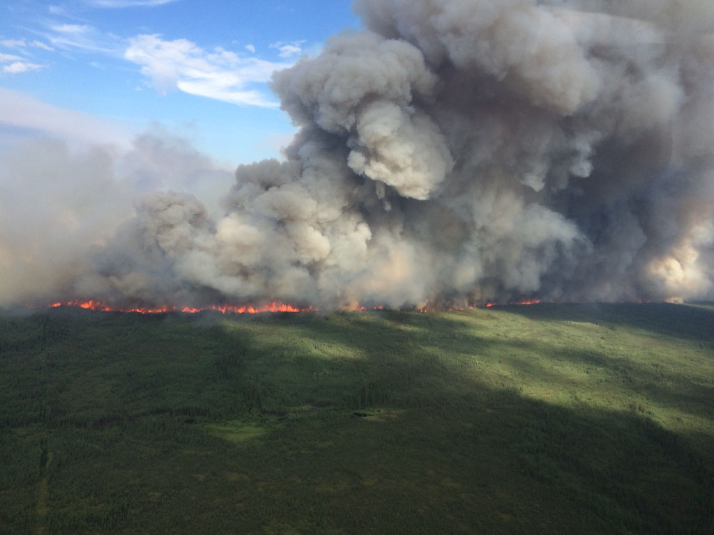
The Beaver Creek fire located approximately Mile 250 (402 km) south of Fort Nelson, closed the Alaska Highway last Wednesday. The fire was discovered Sunday, July 5, and has now consumed 8,200 hectares. It was caused by lightning and it is not an interface fire.
Pilot cars led traffic through the area from just after midnight on Thursday morning to Saturday evening.
“Due to the decrease in fire activity, vehicles will no longer be piloted between 386 km (mile 250) and 418 km (mile 260) on the Alaska Highway,” a spokesman for the ministry stated:
“The highway remains open and traffic is free to travel through this portion of the roadway. Speed will be reduced to a maximum 70 km/hr between 386 km and 418 km.
“For the safety of our crews and other travelling public, please do not stop along this portion of the highway as operational activities are still occurring in the area. Please use caution when driving along the Alaska Highway. Smoke may be visible.”
After the aggressive fire behaviour was observed on July 8, fire activity has significantly decreased. Today firefighters are on site conducting operational activities from the southern flank to the highway.
There are 116 firefighters working this fire with one helicopter and a tanker.
“Over 100 fire fighters are on site today, including 20 out-of-province Type 1 Ontario firefighters. Crews will work on the southern and northern flanks to the highway, continue assess and cut dangerous trees, and mop-up 100 feet from the fire’s edge,” the spokesman said.
Weather for Tuesday called for partly cloudy with possible showers or thunderstorms in the afternoon. A weak frontal system will move through on Wednesday bringing breezy winds and the chance of convective moisture.
Updating the status of the Akue Creek interface wildfire caused by lightning and discovered July 1st, 2015. It is located 20 km southwest of Fort Nelson it has covered an area estimated to be 3,550 hectares. This fire is still not threatening the community of Fort Nelson. Precipitation was received on some areas of the fire yesterday.
Weather for today will be partly cloudy with possible showers or thunderstorms this afternoon. A weak frontal system will move through on Wednesday bringing breezy winds and the chance of convective moisture. One helicopter is working this fire.
The Mount Bigfoot Fire is located 90 km southeast of Fort Nelson and was discovered on Sunday June 28, 2015 was caused by lightning and is an interface fire covering approximately 2,400 hectares. It is not actively being suppressed. The patrol on July 10, showed no significant growth. The fire was burning at low intensity. There is a structure to the east of this fire. The structure has been surrounded by fire retardant and crews have set up sprinkler systems on this structure. This fire is not currently threatening the community of Fort Nelson.
Weather for today will be partly cloudy with possible showers or thunderstorms this afternoon. A weak frontal system will move through on Wednesday bringing breezy winds and the chance of convective moisture.
One helicopter is monitoring the fire.
A fire discovered Sunday, June 28, 20015 south of Barney Lake approximately 72 kilometres east of Watson Lake has covered an area estimated to be 64,120 hectares. It is active and not an interface fire and was caused by lightning. This fire is burning approximately 3 km away from the Alaska Highway. This fire started in the Yukon Territory and spread to B.C. The highway is not currently threatened. The Yukon Wildland Fire Management is managing this fire with 31 firefighters, 5 helicopters and one piece of heavy equipment. Smoke is visible in the area. Please use caution when travelling along the Alaska Highway. This fire remains a priority for Yukon Wildland Fire Management. An incident management team is assigned to this fire. For more information, please contact Yukon Wildland Fire Management at 1-867-332-0886. Or visit: www.yukonwildfire.gov.yk.ca or http://www.community.gov.yk.ca/fire management/current.html
The Wadin Creek fire located approximately north and south of the Kechika River, near Wadin Creek was caused by lightning and is not an interface fire, it is active and covering as area of approximately 38,000 hectares
This fire is located approximately 14km southwest of the Alaska Highway. This fire is not immediately threatening the highway. Smoke will be visible in the area for the travelling public. Please use caution when driving as visibility may be impacted. There is one firefighter and one helicopter on this fire with a modified response. Fire activity is being monitored within set policies and management guidelines, but is currently not being actively suppressed.
Fire is a natural component of the ecosystem and has regenerative properties for the affected terrain. Trigger points indicate where greater risks may develop, and if the fire begins to approach these points, resources may be allocated to the fire to ensure that problems do not arise.
Weather for today will be partly cloudy with possible showers or thunderstorms this afternoon. A weak frontal system will move through on Wednesday bringing breezy winds and the chance of convective moisture.
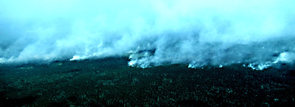
In a release dated July 7, it was reported that over twenty-five wildfires currently burning in the Fort Nelson area has led to thick smoke blanketing numerous northeastern communities including Prophet River, Fort St. John, and Fort Nelson. 116,270 hectares have been burned in northeast BC.
 Follow


Recent Comments